Model category:
all models
beneficial insects
plant diseases
insects
invasive insects
endangered spp.
other crop models
apple and pear
stone fruits and nuts
CROPTIME models
weeds
Select model: (see list)
degree-day calculator (general purpose)
T-Sum 200 Forage Management
Asian citrus psyllid, Diaphorina citri [citrus] OSU OIPMC model analysis
Asian longhorned beetle [num. trees] OSU OIPMC model analysis
apple maggot 1st emerge [cherry, apple] Jones et al 89
apple maggot % emerge [cherry, apple] Jones et al 89
apple scab [apple] Gadoury et al 1995
pear scab infection season [pear] Spotts et al. 2000
Asiatic rice borer (Chilo suppressalis) [rice] OSU OIPMC model analysis
Alfalfa Weevil [alfalfa] U WY from: Harcourt 1981
bertha armyworm [vegetables] Bailey 1976
bronze birch borer [birch trees] OSU OIPMC model analysis
black cutworm [vegetables] UC Davis
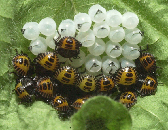
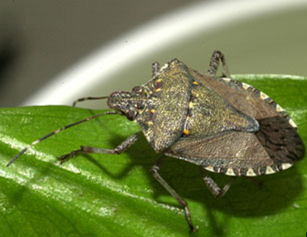
brown marmorated stink bug [multiple] Nielsen et al 08
bean-5630 [direct seeded] Andrews et al. 2020
bean-Provider [direct seeded] Andrews et al. 2020
bean-Sahara [direct seeded] Andrews et al. 2020
broccoli [Arcadia] Andrews et al 2016
broccoli [Emerald Pride] Andrews et al 2016
broccoli [Green Magic] Andrews et al 2016
broccoli [Imperial] Andrews et al 2016
Barley Miller MSU
boxwood leafminer [boxwood] dEustachio and Raupp 2001 OSU OIPMC model revised analysis
cabbage looper [vegetables] Toba et al 1973
corn earworm [sweet corn] Hartstack et al 1976
w. cherry fruit fly v2 [cherry E. of Cascades] Jones et al 91
w. cherry fruit fly [cherry W. of Cascades] AliNiazee 1979
honeydew moth [citrus, many hosts] OSU OIPMC model anal.
chick pea Desi Miller MSU
codling moth revised 07 [apple & pear] Knight 2007
cereal leaf beetle [grasses] Fulton et al 1975
codling moth [apple & pear] Brunner and Hoyt 1987
codling moth (new version) [apple & pear] Brief instruction page
cabbage maggot - OSU DDs info cards (pdf)
cucumber-Marketmore 76 (dir. seeded) Andrews et al 2021
cucumber-Marketmore 76 (transplant) Andrews et al 2021
canola (B. napus, Arg) Miller MSU
canola (B. rapa, Pol) Miller MSU
canary seed Miller MSU
Pear psylla, Cacopsylla pyricola [pear] WSU model
cucumber-Cobra (direct seeded) Andrews et al 2021
cucumber-Dasher II (direct seeded) Andrews et al 2016
cucumber-Extreme (direct seeded) Andrews et al 2016
cucumber-Supremo (direct seeded) Andrews et al 2016
cucumber-Zapata (direct seeded) Andrews et al 2016
downy brome Dan Ball
Diorhabda carinulatata [weed biocontrol] OSU OIPMC model analysis
douglas-fir twig weevil [fir] OSU OIPMC model analysis
douglas-fir needle midge [fir] OSU OIPMC model analysis
emerald ash borer [ash trees] Duarte 2013 OSU OIPMC model analysis
emerald ash borer v2 [ash trees] Duarte 2013 OSU OIPMC model revised analysis
early blight (A. solani) [potato tomato] Gent Schwartz 03
Egyptian cotton worm (Spodop. littoralis) [polyphagous] OSU OIPMC model analysis
european grapevine moth [grapes] UC Coop Ext 2010-11
european pine shoot moth [nursery] Regan et al 1990
Fenders blue butterfly [Kincades Lupine] OSU OIPMC model analysis
cougarblight 2010ez-fire blight [apple, pear] Smith and Pusey 2010
filbertworm [hazelnut] Aliniazee 1983
false codling moth [citrus, many hosts] OSU OIPMC model analysis
Flax Miller MSU
fruittree leafroller [tree fruits & ornament.] Judd et al 93
Galerucella calmariensis [weed biocontrol] OSU OIPMC model analysis v2
USDA ARS grasshoppers [rangeland, crops] OSU OIPMC model analysis
spongy moth egg hatch [mixed oak] Russo et al 1993
spongy moth larvae & pupae [mixed oak] Carter et al 1992
spongy moth from Jan 1 [oak-maple] Sheehan-simpl.
hop downy mildew [hop] Gent et al 2010
CROPTIME models CROPTIME weed model
isomate-c+ Pacific Biocontrol Corporation Data
Japanese flower thrips [vegetables] OSU OIPMC model analysis
Japanese knotweed psyllid, Aphalara itadori [weed biocontrol] CABI abstract
Japanese knotweed UMN model
Japanese beetle [multiple crops] OSU OIPMC model analysis
Japanese pine sawyer beetle [pine trees] OSU OIPMC model analysis
Light Brown Apple Moth [omnivorous] OSU OIPMC model analysis
CROPTIME models CROPTIME weed model
lentil (int. grwth chars) Miller MSU
Lacanobia fruitworm [apple & pear] Doerr and Brunner 2007
Lygus bug [alfalfa seed] Ben Simko 2000
Mormon cricket [rangeland, crops] OSU OIPMC model analysis
mint flea beetle Berry et al
mummy berry infection season [blueberry] Pscheidt 2014
Metaseiulus occidentalis Tanagoshi et al 1975
mint root borer Berry et al
mustard (B. juncea, Brwn&Orntl) MSU
mustard (B. alba, Wht/Yell) Miller MSU
Neoseiulus fallacis Dover et al 1979
Oak Ambrosia Beetle [oak trees] OSU OIPMC model analysis
Oat Miller MSU
obliquebanded leafroller [tree fruits] Brunner et al 1997
obliquebanded leafroller [hazelnut] Gang. and Ali. 1985
oriental fruit moth [stone fruit] CA IPM
omnivorous leaftier [multiple crops] OSU OIPMC model analysis vers. 1.0
orange tortrix (cold winter) [small fruit] Knight 1988
orange tortrix (mild winter) [small fruit] Knight 1988
Helicoverpa armigera [cotton, corn, others] OSU OIPMC model analysis
pink bollworm [cotton] UC Davis Cotton IPM 1996 model
pecan nut casebearer [pecan] Jackman and Harris 1988
pea (yellow-det. or indet. growth) Miller MSU
Photuris frontalis - a synchronous firefly [misc] OIPMC model analysis
Pandemis leafroller [tree fruits] Brunner 1991
pepper-Bell king (transplant 4-7 lvs) Croptime project
pepper-Gatherers gold (transplant 4-7 lvs) Croptime project
pepper-King Arthur (transplant 4-7 lvs) Croptime project
pine shoot beetle [pine trees] OSU OIPMC model analysis
pepper-Stocky red roaster (transplant 4-7 lvs) Croptime project
potato psyllid [potato, tomato] OSU OIPMC model analysis
peach twig borer [stone fruits] 2007 USU Ext.
Pine Tree Lappet Moth [pine trees] OSU OIPMC model analysis
redroot pigweed CROPTIME weed model
Safflower (Saffire) Miller MSU
small broomrape (red clover) Eizenberg et al 2005
sweet corn-4001 [variety 4001-direct seeded] Andrews et al. 2019
sweet corn-Kokanee [Kokanee-direct seeded] Andrews et al. 2019
sweet corn-Luscious DS [Luscious-direct seeded] Andrews et al. 2019
sweet corn-Luscious TP [Luscious-transplanted] Andrews et al. 2019
seedcorn maggot [corn, soybean] IA State
sweet corn-Jubilee DS [Jubilee-direct seeded] Coop et al 1993
sweet corn-Sugar Pearl DS [Sugar Pearl+Temptation-dir. seed] Andrews et al. 2019
sweet corn-Sugar Pearl TP [Sugar Pearl+Temptation-transpl.] Andrews et al. 2019
San Jose scale [tree fruits] Rice et al 1982
spotted lanternfly [numerous including wine grapes, tree fruits, ornamentals] OIPMC Analysis
Spodoptera litura [omnivorous] OSU OIPMC model analysis
silver Y moth (Autographa gamma) [omnivorous] OSU OIPMC model analysis
sunflower early dwarf hybrds Miller MSU
sugarbeet root maggot Bechinski et al 1990
strawberry root weevil [peppermint] Cacka 1982
strawberry root weevil [strawb.] Umble, Fisher 2002
sunflower stem weevil Merrill et al 2010
Neoleucinodes elegantalis [solanaceae] OSU OIPMC model analysis
Sunn pest (Eurygaster integriceps) [wheat, barley] OSU OIPMC model analysis
spotted wing Drosophila [fruit] OSU OIPMC model analysis vers. 3.0
spotted wing Drosoph overwint mortal [fruit] OSU OIPMC model analysis
Tomato leafminer [solanaceae] OSU OIPMC model anal.
tomato [Big Beef] Croptime project
threecornered alfalfa hopper [legumes, grapes] OSU OIPMC model analysis
tomato [Indigo Rose] Croptime project
tomato [Monica] Croptime project
tomato [New Girl] Croptime project
variegated cutworm [peppermint] Coop & Berry 1987
western bean cutworm [corn & beans] Neb. IPM
western flower thrips [vegetables] OSU OIPMC model analysis
wheat (Bauer model) [spring wheat] Bauer et al 1984
walnut husk fly [walnut] Kasana & AliNiazee 1997
wheat (Hard Red) Miller MSU
winter wheat Karow et al 1993
wild parsnip UMN model
wheat stem sawfly OSU OIPMC model summary
(model params)
Output in:
Fahrenheit °F
Celsius °C
Start:
Jan
Feb
Mar
Apr
May
Jun
Jul
Aug
Sep
Oct
Nov
Dec
1
2
3
4
5
6
7
8
9
10
11
12
13
14
15
16
17
18
19
20
21
22
23
24
25
26
27
28
29
30
31
1994
1995
1996
1997
1998
1999
2000
2001
2002
2003
2004
2005
2006
2007
2008
2009
2010
2011
2012
2013
2014
2015
2016
2017
2018
2019
2020
2021
2022
2023
2024
2025
Starting date instructions: calendar date - set on Jan 1
Jan
Feb
Mar
Apr
May
Jun
Jul
Aug
Sep
Oct
Nov
Dec
1
2
3
4
5
6
7
8
9
10
11
12
13
14
15
16
17
18
19
20
21
22
23
24
25
26
27
28
29
30
31
same yr
next yr
Note - start date reset to database default. Model validation status: under development - new invasive species
Region(s): data collected in PA Forecast type:
after 7day use 10 year averages (default)
after 7day use 30 year averages
after 7day use last years data
after 7day use data from 2 years ago
after 7day use NMME extended seasonal forecast
after 7day use CFSV2 extended seasonal forecast
Model
0
1
2
3
4
5
6
7
all
future
Output:
[Home]
[user survey]
[Intro]
[US State/Network Index]
[DD Map Calculator]
[Links]
All data provided "as is" and users assume all risk in its use - see full disclaimer . All NWS derived data
is not subject to copyright protection.
This site hosted by the Integrated Plant Protection Center at Oregon State University with support from the USDA National Plant Diagnostic Network, The OSU Agricultural Experiment Station, various USDA CSREES/NIFA grants, USDA SARE, USDA RMA, and USDA IPM Centers - Western Region.
Climate map data provided by OSU PRISM Group, real-time public weather data provided by U. Utah Mesowest and other networks including WSU AgWeatherNET , AGRIMET , CPS Adcon Networks , IFPNet Automata , California CIMIS , California PestCast , and others.
Previous versions online since May 16, 1997, this version 5.6, updated Jan 3, 2025
coopl@science.oregonstate.edu
if you have any questions about this program.
 El Monte CA station: KEMT METAR elev: 295 ft
lat/long: 34.0831 -118.0331
El Monte CA station: KEMT METAR elev: 295 ft
lat/long: 34.0831 -118.0331