| Projects: Name / Description: |
GRASS Location | GRASSLinks Project Code | |
| Swiss Needle Cast Risk Model Version 1 | nw_nl | - | b |
| ARC GRID (RASTER) FILES: Name / Description: Click item to view thumbnail |
Metadata Available? | zipped arcgrid data download |
GRASSLinks Project(s): |
|
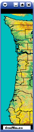
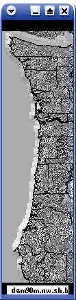
90m elevation NW USA |
Y | - | abejklmnopqrswz |
|
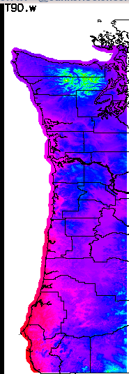
Avg Dec-Feb PRISM based temperatures downscaled to 90m res. |
Y | T90_w.zip
N/A |
b |
|
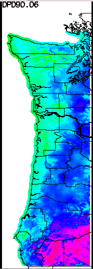
Avg PRISM-based June dew point deficit (T-Dewpt) 1996-2006 downscaled to 90m res. |
Y | DPD90_06.zip
N/A |
b |
|
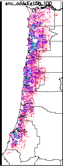
SNC Survey data 1996-2006 converted to needle retention (yrs x 100) |
Y | snc_add_Est5b_100.zip
N/A |
b |
|
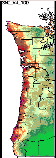
2008 SNC needle retention (yrs x 100) model - based on climate factors |
Y |
SNC_V4 Full extent utm N/A WA only N. OR only C. OR only S. OR only utm N/A |
b |
|
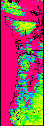
aspect at mid elevations (x100); 90 meter resolution |
Y |
asp36_100.zip
utm N/A |
b |
|
vhires shade relief NW USA |
Y | - | abejklmnopqrswz |
| SHAPE (VECTOR) FILES: Name / Description Click filename to view thumbnail |
Metadata Available? | zipped shapefile data download |
GRASSLinks Project(s): |
| County lines |
N | - | abejnopqrstuw |
| Shape files - regional 4 sec/120m (high resolution) and full extent 5 sec/150m conversion from SNC needle retention climate factors model (SNC_V4) (values are needle retention (yrs) times 10) Note: for .prj files, try using the following: GEOGCS["GCS_North_American_1983",DATUM["D_North_American_1983", SPHEROID["GRS_1980",6378137,298.257222101]], PRIMEM["Greenwich",0],UNIT["Degree",0.0174532925199433]]
|
Y |
WA (4 sec) lat long: snc_p4_WA.zip N. OR (4 sec) lat long: snc_p4_NOR.zip C. OR (4 sec) lat long: snc_p4_COR.zip S. OR (4 sec) lat long: snc_p4_SOR.zip OR+WA full coast (5 sec) lat long: snc_p4_5sec_all.zip
WA (200m) utm: |
b |
| SITES FILES: Name / Description Click filename to view thumbnail |
Metadata Available? | GRASSLinks Project(s): | |
| NW place names |
N | - | dabeklmnopqrstuz |
| SNC sample data - PCT+costal GIS sites |
N | - | b |
Disclaimer: Use of GRASSLinks and the data accessed by it is provided as-is without any guarantees of quality, completeness, currentness, or performance. For more information, see the GRASSLinks (c) Copyright and Disclaimer.